Since its inception in 2012, the Basin Society has collected a large body of technical data and literature,
which was required to develop the necessary scientific baseline of the Shawnigan Lake watershed
for the purposes of credible knowledge, good judgement, and long-term decision making.
which was required to develop the necessary scientific baseline of the Shawnigan Lake watershed
for the purposes of credible knowledge, good judgement, and long-term decision making.
SHAWNIGAN LAKE ROAD ENDS INFORMATION STUDY
CVRD Parks Masterplan 2010
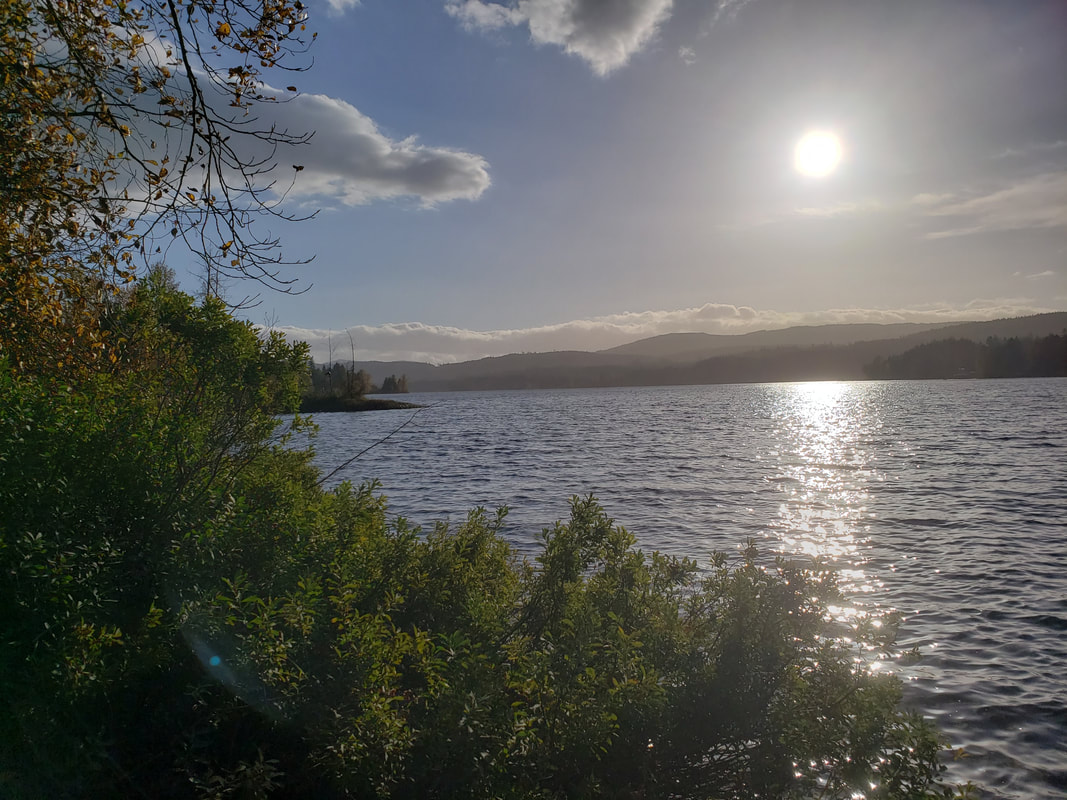
RIPARIAN FORESHORE & WETLANDS RESOURCES
Shawnigan East Wetlands |
|
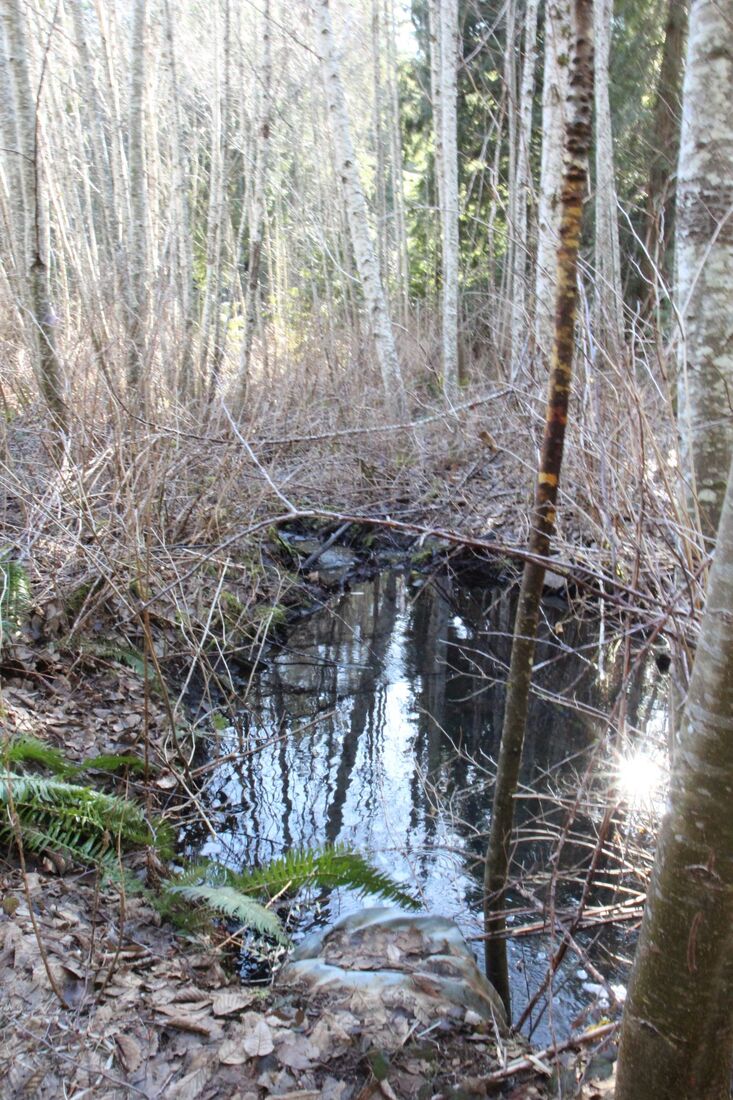
Taylor Park Wetlands
|
| ||||||||||||||||||
FORESHORE: SVRT Presentation June 2021
Shawnigan village rail trail environmental concerns REPORT
Shawnigan Village Rail Trail Phase 3,4&5 Staff Report
| pages_from_easc_2022_0420_svrt_packet_20220414201225113__1_.pdf |
KOKSILAH WATERSHED
PROVINCIAL WATER PROGRAM INFORMATION
|
|
|
|
|
Synthesis Reporting
Amalgamating approximately 30 documents to produce one comprehensive report
This informative paper, synthesized by SBS Director Dr. Linda Gregory, summarizes both historical and present land use literature pertaining to the Shawnigan Lake watershed while focusing on their hydrological implications. The paper closely examines water quality, lake limnology, water chemistry, and sediments.
dr._linda_gregory_sl_report.pdf
Water Quality Reports & Studies
Shawnigan Lake 2020 Water Quality Report
AQUIFERS: Cobble Hill,
|
Aquifers: An Introduction | ||
|
Ditto. (2017). South Shawnigan Creek Water Quality Study Quarterly Summary Report #2.
http://www2.gov.bc.ca/assets/gov/environment/air-land-water/site-permitting-and-compliance/sia/shawnigan_creek_wq_study_q2_report.pdf
Ditto (2016). South Shawnigan Creek Final Monitoring Study Design.
http://www2.gov.bc.ca/assets/gov/environment/air-land-water/site-permitting-and-compliance/sia/final_rpt_shawnigan_study_design_jul_2016.pdf
Ditto (n.d.). South Shawnigan Creek Water Quality Monitoring Study - Draft Terms of Reference.
http://www2.gov.bc.ca/assets/gov/environment/air-land-water/site-permitting-and-compliance/sia/tor_sshawnigan_creek_monitoring_2016-05-03.pdf
Rieberger, K., Epps, D. and J. Wilson (2004). Shawnigan Lake Water Quality Assessment 1976 – 2004. British Columbia Ministry of Water, Land and Air Protection.
https://www.cvrd.ca/DocumentCenter/View/84524/Shawnigan-Lake-Water-Quality-Study---2004?bidId=
|
CVRD. Shawnigan Lake North Water System Annual Report.
https://www.cvrd.bc.ca/DocumentCenter/View/442
British Columbia Ministry of Environment. (2017). PE-105809 Upper Shawnigan Sediment Sampling Results, Fall 2016.
https://www2.gov.bc.ca/assets/gov/environment/air-land-water/site-permitting-and-compliance/sia/2017-01-31_upper_shawnigan_watershed_sediment_sampling_bio_note.pdf
GREGORY, L. (N.D.).
SUMMARY OF THE AVAILABLE INFORMATION ON SHAWNIGAN LAKE, WITH AN EMPHASIS ON WATER QUALITY.
Ditto. (1996). Fecal coliforms in Shawnigan Lake, Vancouver Island, during August 1995. Water Quality Branch, Environmental Protection Department.
https://www2.gov.bc.ca/assets/gov/environment/air-land-water/water/waterquality/monitoring-water-quality/west-coast-wq-docs/wq_shawnigan_coliforms_1996.pdf
| ||||||||||||||||||
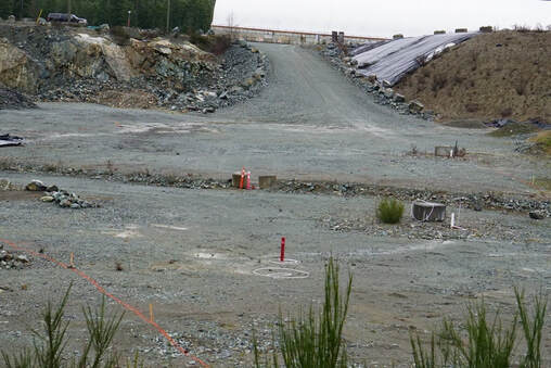
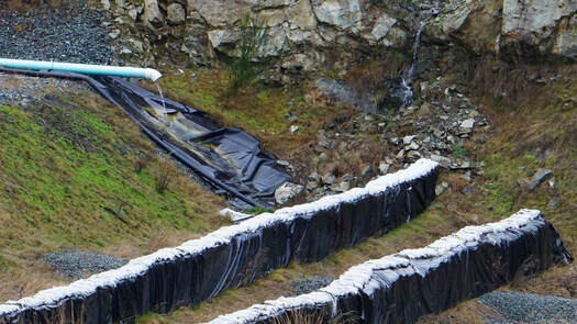
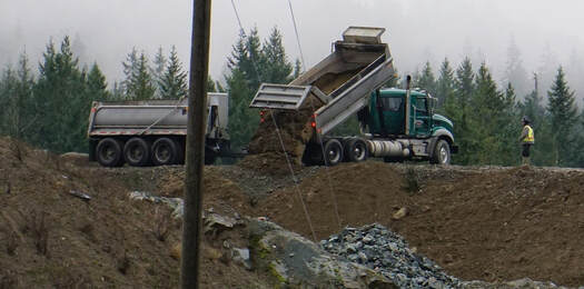
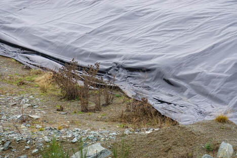
LAND USE ISSUES: Reporting and related information
South Island Aggregates 2019 2020
|
|
Follow this link for more information on the SIA contaminated fill site
|
|
|
Incorporation
Municipal Incorporation: What do we get, what do we pay for and is it worth it?
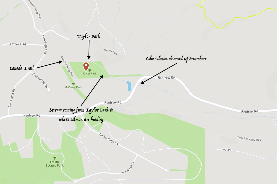
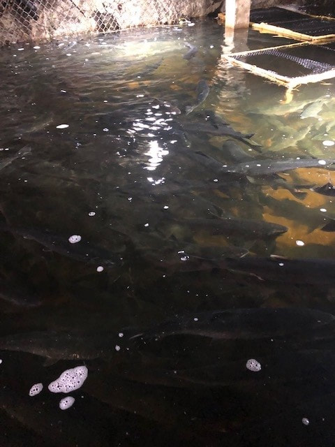
FISHERIES Reports
|
| ||||
Forestry Reports
|
|
|
|
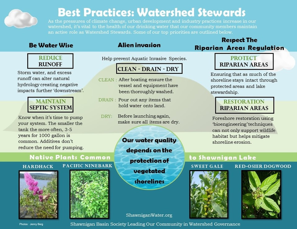
Milfoil
COLDWATER
EURASIAN MILFOIL REMOVAL PROGRAM
Change Approval and Notification
(Changes In and About a Stream)
To conduct the removal process outside of the window because that is when the water is cold enough to limit the spread of milfoil due to fragmentation followed by vegetative reproduction.
| 1006032_notice_of_authorized_change.pdf |


BC MoE. Water Quality. Technical Publications Concerning Aquatic Plant Management.
http://www.env.gov.bc.ca/wat/wq/public/tpcapm.html
Royal BC Museum (n.d.). Eurasian Watermilfoil, Myriophyllum spicatum.
http://alienspecies.royalbcmuseum.bc.ca/eng/species/eurasian-watermilfoil
Okanagan Basin Water Board (2107). Milfoil – Overview
http://www.obwb.ca/milfoil/
Invasive Species Council of British Columbia (2015). Eurasian Watermilfoil Myriophyllum spicatum.
http://bcinvasives.ca/documents/Eurasian_Watermilfoil_TIPS_Final_02_18_2015.pdf
NOAA GLANSIS (2016). Myriophyllum spicatum L.
https://nas.er.usgs.gov/queries/greatlakes/FactSheet.aspx?SpeciesID=237
Maki, P. (2016). Eurasian Milfoil Control Program Christina Lake, BC. Regional District of the Kootenay Boundary. 2016 Annual Report. https://www.rdkb.com/LinkClick.aspx?fileticket=UpGmyx2MIco%3D&tabid=598
Freeman, C. (2015). Eurasian Milfoil Control Program Christina Lake, BC. Regional District of the Kootenay Boundary. 2014 Annual Report. https://www.rdkb.com/LinkClick.aspx?fileticket=fOji7KIX_zI%3D&tabid=598
Fraser River Basin. (2014). Nicola Lake Eurasian Watermilfoil Management Planning: Fisheries Utilization Assessment. http://www.fraserbasin.bc.ca/_Library/TR/nicola_lake_ewm-fisheries_oct_2014_mr.pdf
Ditto (2013). Water Quality and Eurasian Watermilfoil Technical Workshop: A workshop to support the health of Cultus Lake and Nicola Lake.
http://www.fraserbasin.bc.ca/_Library/FVR/ws_summary_ewm_march_2013_web.pdf
Chin, C. (2012). Increased levels of phosphorus at Christina Lake a concern.
http://www.grandforksgazette.ca/news/increased-levels-of-phosphorus-at-christina-lake-a-concern/
Minnesota Sea Grant (n.d.). Eurasian Watermilfoil (Myriophyllum spicatum).
http://www.seagrant.umn.edu/ais/watermilfoil#id
Parkinson, H. et al. (2011). Biology, Ecology and Management of Eurasian Watermilfoil (Myriophyllum spicatum L.). http://store.msuextension.org/publications/AgandNaturalResources/EB0193.pdf
Washington State Department of Ecology (n.d.). Non-native Invasive Freshwater Plants.
http://www.ecy.wa.gov/programs/wq/plants/weeds/aqua003.html
VIDEOS
Eurasian water milfoil hand removal at Pike Lake https://www.youtube.com/watch?v=fuggpqm780k
Milfoil Divers in Christina Lake: https://www.youtube.com/watch?v=mhBSbIqagg8
Eurasian water milfoil hand removal at Pike Lake https://www.youtube.com/watch?v=fuggpqm780k
Milfoil Divers in Christina Lake: https://www.youtube.com/watch?v=mhBSbIqagg8
Web Design by VedaWorks and the Shawnigan Basin Society